4 - Trearddur to Holyhead
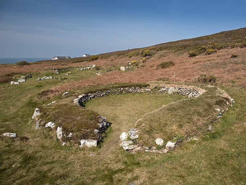
Ty Mawr Hut Circles -"Cytiau'r Gwyddelod"
The huts are near a minor road leading to South Stack , opposite the first RSPB car park.
Low stone walls remain of the 20 wooden roofed structures , by the Ty Mawr farm , excavated and carefully maintained by Cadw.
A settlement built some 2500 years ago and occupied for 1000 years.
The circular structures are probably family homes with the rectangular ones workshops or animal sheds.
The Iron Age farmers grew oats, barley , wheat , kept livestock and collected seafood.
These hut circles are known, in Welsh, and marked on the OS maps, as Cytiau'r Gwyddelod - "Irishmen's Huts"
Ref: NW 764
Date: 29/04/2022
Location: SH 2120 8198